Andiamo to the Aosta Valley


Three days in the Aosta Valley prove: a visit to Italy’s smallest region is always worthwhile. Especially hiking enthusiasts will be in their element, thanks to the new Cammino Balteo long-distance trail.
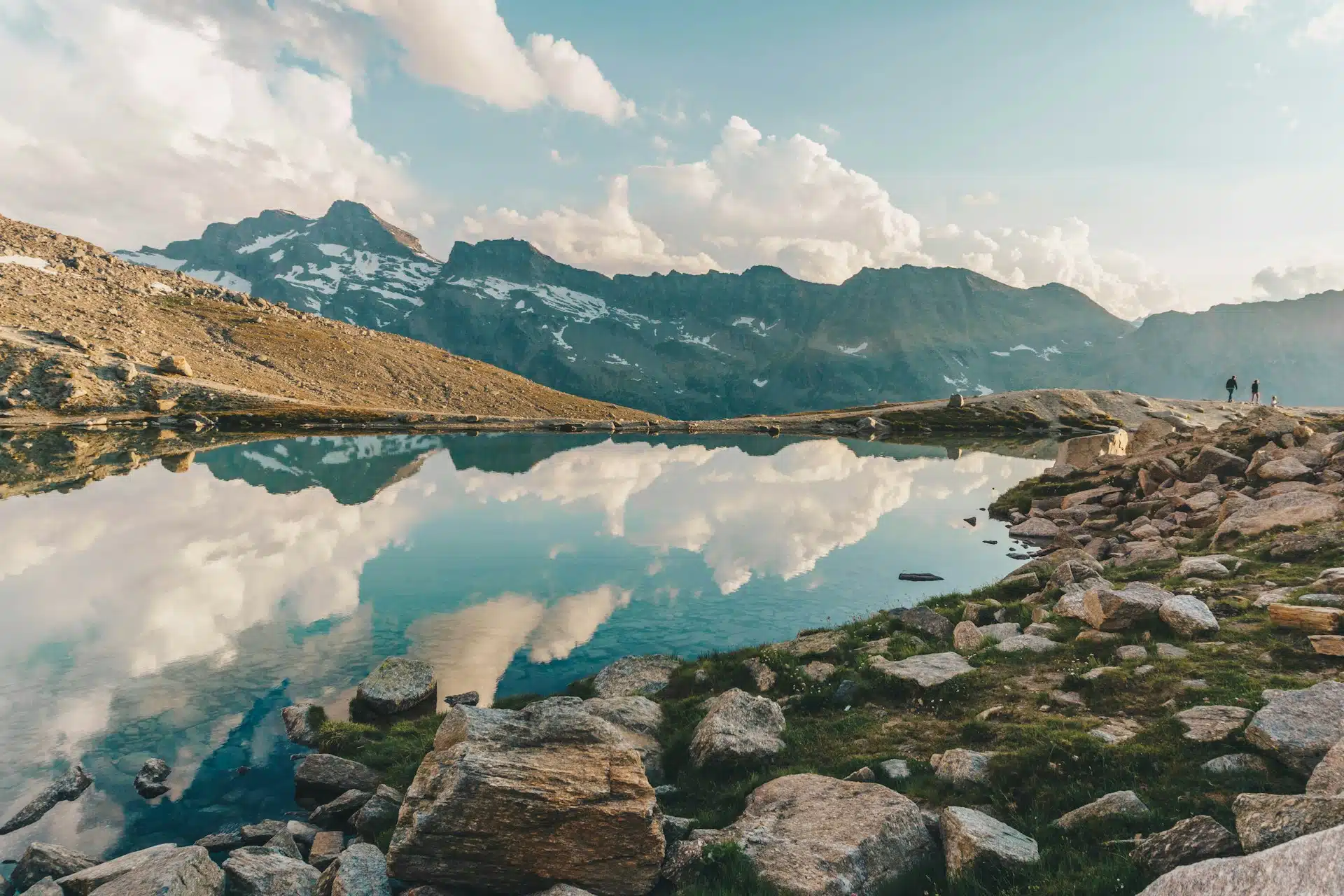
H ere and there, something stirs in the undergrowth beside the trail before swiftly vanishing into the forest. Lizards. Likely warming themselves in the golden rays of the late summer sun. They must have heard our footsteps from afar. Though the sun still carries the warmth of summer, autumn is already making its presence known – the path is blanketed in withered leaves that rustle softly beneath our steps. The scurrying of lizards becomes a familiar sound along the new Cammino Balteo circular hiking trail. Stretching 350 kilometers across the Aosta Valley and passing through 46 municipalities, the route unfolds in 23 stages. Quite a journey. We complete three of them on this sunny weekend.
The mountains as our companion
We’re on the longest of the three sections, beginning in Introd and ending 12.5 kilometers later in Villeneuve. Our guide, Felicity Roulet, spontaneously suggests adding a scenic detour to explore a neighbouring side valley. We agree – it’s hard to resist her pleasant blend of French-Italian charm and enthusiasm. The first rays of sunlight creep over the jagged peaks, chasing away the shadows still lingering over the meadows and woods. As we enter the forest, a line of mountains accompanies us from across the valley. These aren’t yet the four-thousanders of the Gran Paradiso, but they’re no less impressive. We gain elevation quickly, though altitude changes on the Cammino Balteo are mostly gentle. The trail was purposefully laid out at lower elevations to remain accessible well into the cooler seasons.
Horn by horn
We’re also followed by the presence of water – usually flowing through a ru. In Switzerland, these historic irrigation channels are better known as Suonen or Bissen, particularly in Valais. Some sections of the trail reveal the open channels; in others, the water rushes invisibly beneath us, its gurgling and murmuring only heard through narrow shafts along the path.
We soon hear and see water in much greater volume: emerging from the forest, we cross the Torrente Savara via a bridge and continue along the opposite side of the valley. The Savara is one of several rivers cutting through the Gran Paradiso National Park. We’ve been hiking through this protected area since the beginning of our stage. Spanning 70,000 hectares, the park stretches from the valley floor to the 4,061-metre-high Gran Paradiso itself. In 1920, King Victor Emmanuel III donated the land to the Italian state – under the condition it be preserved. Italy’s first national park was born, officially opening in 1922.
The ibex played a central role in the park’s creation. To protect the species from extinction at the hands of poachers, King Victor Emmanuel II had declared the Gran Paradiso area a royal hunting reserve as early as 1856. He alone was allowed to hunt the ibex. And hunt he did – as the walls of Sarre Castle still attest. Today, the castle is lined with hundreds of ibex horns, trophies from his excursions and those of his son, Umberto I.
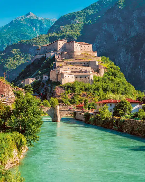
Valley of castles and palaces
We’ve now climbed a bit higher and are walking along a narrow but easy trail above the Talrille, heading toward Villeneuve. The air is thick with the scent of pine. Suddenly, the view opens wide across the Aosta Valley. On the far side, we spot the rooftops of Introd – and, in the distance, Mont Blanc itself, its summit veiled in a soft cloud. The end of our hike is near. But just before we reach it, a final surprise: the medieval tower of Châtel Argent rises behind a bend. Built around 1275, the dramatic ruin prompts a collective “Oh!” – a picture-perfect ending to an already memorable day.
The Aosta Valley is, after all, a valley of castles and palaces. Many are open to the public, some are still privately owned. Some have been lovingly restored, others crumble into ruin. But they all have one thing in common: along the Cammino Balteo, they’re ever-present companions.
Further information
The Cammino Balteo
The newly developed 350-kilometre circular hiking trail is divided into 23 stages. Each stage can take up to seven hours to complete, with altitude differences of up to 700 metres. Traversing 46 municipalities in the Italian Alpine region, the hikes are rated as moderately challenging – making them suitable for experienced hikers as well as, in parts, for families. Good to know: all 23 stage starting and end points are accessible by public transport.
Getting to the Aosta Valley
The town of Aosta lies 70 kilometres from Martigny and 134 kilometres from Geneva. If you’re travelling by car, you can reach the city from Switzerland via the Mont Blanc Tunnel or the Great St. Bernard Tunnel. Public transport is also a convenient option for getting to Italy’s smallest region. For instance, a bus runs twice daily from Martigny to the Aosta Valley, taking around two and a half hours.

